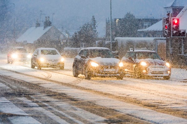
As Storm Goretti’s influence wanes through Friday further snow and ice warnings have been issued, with disruption likely for much of Scotland and northern England on Sunday.
Storm Goretti has been an impactful weather system, with significant disruption and impacts reported so far. A peak gust of 99mph was reported at St Marys on the Isles of Scilly, the highest here since 1991.
Accumulations of snow have also been reported, 15cm has been recorded at Lake Vyrnwy in Powys, 7cm at Preston Montford in Shropshire and 7cm at Nottingham.
Wider accumulations have been recorded, as well as some higher unofficial totals from non-Met Office observations. Notable snow accumulations continue in Scotland, with 27cm at Altnaharra in Sutherland, 26cm at Loch Glascarnoch and 22cm at Durris in Kincardineshire. The lowest temperature recorded overnight was -13.3°C at Braemar, Aberdeenshire.
The influence of Storm Goretti will reduce through Friday, though the system will be responsible for the further wet weather in eastern parts of England through the day as the system gradually moves towards mainland Europe.
Conditions will now gradually improve, resulting in a period of respite for many on Saturday with some sunny spells at times. However, further ice and wintry showers, with some snow on high ground, are likely to affect many northern areas and Wales. Ice and snow warnings have been issued for this.
Saturday’s period of calmer conditions for many is relatively short-lived, as another front arrives from the west on Sunday. This brings the risk of further snow which has the potential to be disruptive with warnings issued for this.
Met Office Chief Forecaster Steve Willington said: “Following on from a Saturday which will be largely dry away from northeastern parts of Scotland and England, a front from the west on Sunday will bring snow for parts of Scotland and northern England with low temperatures continuing the ice risk.
“A further 2-5cm of snow is possible to accumulate at low levels within the warning area on Sunday, with 10-20cm possible over higher ground. With much of this falling in areas that have already seen severe snowfall, ongoing disruption is likely. Those in central and southern England and Wales will see this fall as rain, in what will be a wet Sunday for many.”
A combination of melting snow and rain increases the flood risk for some in the coming days. David Morgan, SEPA Flood Duty Manager, said, “As temperatures rise following recent cold conditions, thaw of lying snow from Sunday onwards will increase the risk of flooding.
“Possible impacts could include flooding of low lying land, roads and individual properties. Keep up to date on the latest information by checking our three-day Scottish Flood Forecast .”


